| System Architecture |
|---|
 |
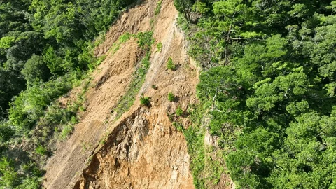
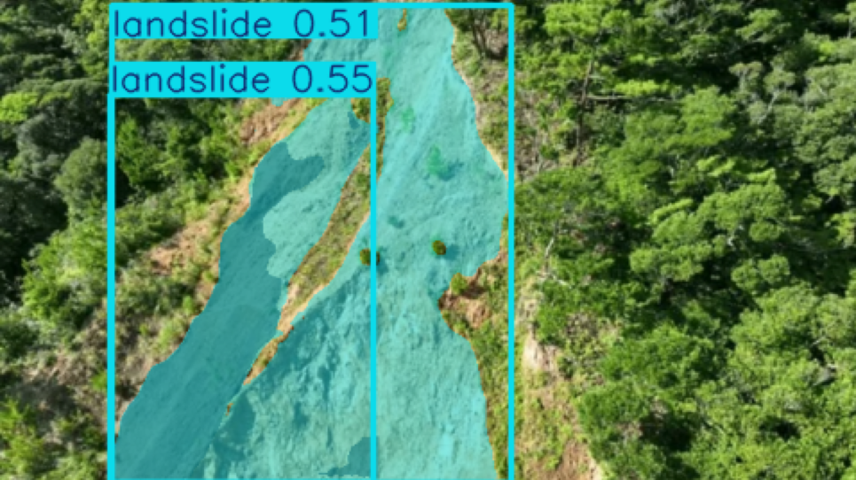
The proposed system is a hybrid deep-learning architecture for landslide detection and segmentation from satellite, aerial, and drone imagery. Currently, the project is in the training and development phase. The main objective is to detect landslide regions and generate pixel-level segmentation masks for accurate localization.
The overall pipeline is:
| Landslide Original Image | Detected Landslide area |
|---|---|
 |
 |
The input RGB image passes through two convolutional layers:
Each convolutional layer uses Batch Normalization and SiLU activation.
The CNN extracts local features such as:
- Terrain edges
- Soil texture
- Vegetation patterns
- Geological boundaries
The resulting 64-channel feature map is converted into a sequence and processed using 4-head Multi-Head Self-Attention (MHSA).
The Transformer captures long-range spatial relationships between different regions of the image. This helps the model understand broader terrain context rather than relying only on local patterns.
The Transformer output is projected from:
using a
The projected feature is then combined with the original RGB image using a residual connection:
The residual connection preserves the original image information while adding learned spatial and contextual features.
The enhanced representation is passed to YOLOv12s Segmentation.
The model generates:
- Bounding boxes — location of the detected landslide
- Confidence scores — prediction confidence
- Segmentation masks — exact affected region
Therefore, the system performs both object detection and pixel-level segmentation.
The current training configuration uses:
-
Input resolution:
$640 \times 640$ - Optimizer: AdamW
- Learning-rate scheduler: Cosine learning-rate scheduling
- Hardware: GPU acceleration
Data augmentation includes:
- Mosaic
- MixUp
- Copy-Paste
- Rotation
- Scaling
- Horizontal/vertical flipping
- HSV augmentation
These augmentations improve model robustness against different terrain, illumination, vegetation, and environmental conditions.
The landslide model is currently under training and evaluation. Once satisfactory performance is achieved, it will be integrated into the larger real-time disaster monitoring system.
In the final system, multiple satellite, aerial, or drone feeds can be analyzed simultaneously, and the detected disaster information can be passed to an AI-based decision-making agent for further monitoring and response.
| Component | Description |
|---|---|
| Input | Satellite, aerial, or drone RGB imagery |
| CNN | Extracts local spatial features |
| Transformer | Captures long-range spatial relationships |
| Feature Projection | Projects |
| Residual Fusion | |
| Detection Model | YOLOv12s Segmentation |
| Output | Bounding boxes, confidence scores, and segmentation masks |
| Resolution | |
| Optimizer | AdamW |
| Scheduler | Cosine Learning Rate |
| Augmentation | Mosaic, MixUp, Copy-Paste, Rotation, Scaling, Flipping, HSV |
| Current Status | Training and evaluation |
| Future Integration | Real-time disaster monitoring and AI decision-making agent |
Notebook Link - https://www.kaggle.com/code/sayaksamanta/landslide-detection-engine-v26